Tuesday, June 9, 2015

Home

6/6/15
We saw many other looper boats in Manasquan. Everyone was stuck here because of the bad weather. The only option now for travel was the ocean and the weather just wouldn't cooperate. We were going bleery eyed reading many different weather forecasts. We were determined to get home and decided to try even though the forecast wasn't great. 

We left the dock at 5:30 AM and headed out the inlet. It was a bit rolly, but tolerable. It was rainy and foggy, but finally it wasn't windy. To get home sooner, Al brought our speed up to 15 mph. As we got closer to home the ocean got calm, the rain stopped, and the fog disappeared. It was great to see Jones Inlet, "our inlet". It's so easy traveling on familiar waters. We were tied up at our dock at 9:20 AM
Hooper couldn't wait to get off the boat and run in his yard. Al couldn't wait to start his Mustang. Now we all have to get used to living on land again.

Summary for the Great Loop:
We left home 6/28/14 and returned 6/6/15.
We put 669 hours on the engine and 151 hours on the generator.
We bought 2774.21 gallons of diesel at a cost of $9772.77
We stopped at 96 different marinas or docks for a cost of $8731.04

We had countless amazing adventures, were sometimes scared, met many interesting people, and made some great friends.

Manasquan

6/5/15
Our next stop was Manasquan, NJ. We stayed in Atlantic City for three days waiting on the weather. We would much rather wait in Atlantic City than Manasquan. We went to the casino, walked the boardwalk and enjoyed several different restuarants. We got to see two very cool Navy boats driven by Navy Seals come into the marina. 

We met the owners of three other boats. One was a newish Grand Banks named Dollinger. They arrived in Atlantic City the same day as us, but they traveled in the ocean. They were pretty shaken up that day as they faced 10ft. waves in the ocean and had a pretty scary day. The other boat was an older Grand Banks named Bella. They also arrived the same day as us, but they traveled on the inside and were one of the boats we heard on the VHF calling for SeaTow because they hit bottom and were stuck. The other boat was a 68ft. Searay. We were all getting tired of being here and wanted to leave. We decided we would travel on the inside up to Manasquan. The two Grand Banks owners decided to follow us, because the ocean was still too rough. We would be the lead boat because we had the shallowest draft and would tell them the depths that we were seeing. The Searay owner had a 6ft. draft and didn't think he could make it through the shallow waters. He was determined to go out in the ocean. He left at first light, headed out the inlet, almost flipped over in the big waves, and came right back in to his slip. He then decided to follow us on the inside to Manasquan.

We left the dock at 8AM so that we could travel through the shallowest spots at high tide. It was just about the worst weather possible. It was extremely windy, rainy, foggy and cold. It was critical that we see every bouy to stay in the channel, and the weather made it difficult to see anything. It was a long slow day in shallow waters staring at the depth finder, but we all made it to Manasquan without hitting bottom.

We were so happy to be in Manasquan and the weather forecast was looking like we could travel in the ocean and make it home tomorrow.


The 3 boats that followed us


Point Pleasant Canal

Manasquan River Bridge

Manasquan Railroad Bridge

Wednesday, June 3, 2015

Atlantic City

We kept checking the weather forecast and it really wasn't looking good to travel in the ocean. We decided to try the inside route eventhough everyone on the dock said it would be too shallow. We left the marina at 5:30 AM on a rising tide hoping that would give us enough water to get through the really shallow spots. The other boats that we were supposed to travel with in the ocean never left the dock. It was extremely windy, cold and rainy, so we drove the boat from inside the cabin with the heat on. It was so windy that there were waves on the Intracoastal. There was only one spot with really shallow water and we were able to get through with just a wisker under the keel, but we never touched bottom. That is quite an accomplishment, as we heard two other boats on the VHF calling for a tow as they were stuck on the bottom. We made it to Atlantic City and went to the Farley State Marina at the Golden Nugget Casino. The weather forecast looks terrible for the next week, so we may be here awhile. 


The boat right next to us came in later in the day after us. They traveled out in the ocean and said the waves were 10ft. high.

The big yacht docked right behind us was also in the Riviera Beach Marina in Palm Beach where we spent the winter.

Absecon Lighthouse


Monday, June 1, 2015

Cape May, NJ

5/31-6/1/15
The weater forecast wasn't great, but we decided to leave anyway because we didn't want to be stuck in Delaware City any longer. We knew if we didn't leave today we would have to sit here for several more days because the weather was going to get even worse. We waited until 11:00 to leave, which is very unusual, because we wanted a favorable current to head down Delaware Bay. The first part of the trip was great. It was sunny, with a gentle breeze, and the water was very calm. About 20 miles from Cape May, New Jersey the wind and waves really picked up. It actually felt like gale force winds. It was hard on our eyes to look directly into the wind. The waves quickly grew to 3-4 foot, closely spaced, with occasional 5-6 foot waves. We had waves going over the bow and spray going over the flybridge. We have our flybridge all open, so soon we were soaking wet. Poor Hooper was so wet he looked like he had gone swimming. In fact when we finally got to the marina in Cape May, the dock kid asked us, "Where did you let the dog go swimming in this wind?" I can laugh about it now, but we weren't laughing then. We were just happy to be at a marina with the days travel over.

We stayed at Utsch's Marina and saw 8 other looper boats waiting on the weather. We plan to spend an extra day in Cape May to relax and see the cute town. The weather really doesn't look good for the next week. Two or three other boats plan to leave tomorrow at 5 AM and head out into the ocean. We plan on going with them. The other boats are all bigger than us, so we may have more trouble with the ocean waves, but we'll give it a try. If it looks too rough we'll come back in and try to go the inside route to Atlantic City. We really don't want to go this route because the waters on the inside of Jersey are so shallow, even at high tide.


Nuclear plant in Jersey

Ship John Shoal Light

Hooper is not happy with the waves or the spray on the flybridge. At one point he looked like he was going to jump overboard just to get off the boat. I had to hold his collar to keep him near me, which I never had to do before.

So happy to be in the calm waters of the Cape May Canal

One more state to go through and we're home.

Big ferries go to the other side of Delaware Bay

Along the Cape May Canal

Very old and rusty railroad bridge


Delaware City

5/30/15
Now we're getting really anxious to get home, so we left Annapolis and headed all the way up the bay to the C & D Canal. The Chesapeake and Delaware Canal is a 14-mile-long, 450-foot-wide and 40-foot-deep ship canal that connects the Delaware River with Chesapeake Bay. The wind is still blowing hard from the south making big waves on the stern. We're getting tired of surfing the boat on these waves everyday as the autopilot works hard trying to keep us going straight.

We wanted to stop for the night in Chesapeake City, but because it was the weekend the place was packed. We decided to press on and stopped at Delaware City Marina. We were stuck at this marina for several days due to bad weather the last time we were in this area. Delaware Bay is notorious for being rough when the wind is from the south. We really don't want to get stuck here again, because there's not much going on in this town, but the weather forecast doesn't look good.


Sandy Point Shoal Lighthouse 

The upper Chesapeake is very pretty, and reminds us of upstate New York


This ship is ready to respond to an oil spill on Delaware Bay or the upper Chesapeake.

Bridge on the C & D Canal


Friday, May 29, 2015

Annapolis

5/28-29/15
When we woke up it was very cloudy and the wind was really blowing, so we were concerned that we wouldn't be able to travel today. We left Tangier through the west channel the way we came in. Once we got out of the opening onto the Chesapeake, the waves were really big and hitting us on the side causing us to roll uncomfortably. We knew we couldn't tolerate these waves for long, so we turned around. We went back past the marina and tried the east channel. To the east of Tangier Island is Tangier Sound, which is much narrower and more protected than the Chesapeake. It was still pretty rough on this side but we were able to turn so the waves were on our stern. We could travel awhile on Tangier Sound, but then we would have to cut back over to the Chesapeake eventually. It was funny because to get back to the Chesapeake we had to go through Hooper Straight which is just south of Hooper Island. Somehow this area knew we had a dog named Hooper onboard that doesn't like rough water. As we came through this straight the Chesapeake was much calmer and continued to get calmer as the day went on. Soon the water was very calm, the sun came out and we had a great trip. It calmed down so much that we decided to press on all the way to Annapolis.

We had never been to Annapolis before so we weren't sure where to stay, but we usually like to be close to town. The City Dock is right in the heart of town and has a section called Ego Alley. It's a small canal where people parade up and down all day in their boats to see what's going on in town or to go to a restaurant or bar. We parked right in the middle of Ego Alley and enjoyed all the activity. 

We decided to stay an extra day to relax and see a little bit of Annapolis. We took a trolly tour around town and saw lot's of the famous places and learned the history of the area. We then went to Pusser's Restaurant for lunch and orded the famous Painkiller cocktail. It made us feel like we were back in the BVI's.


Hooper Island Lighthouse

Thomas Point Lighthouse

Coming into Annapolis Harbor


Trolly tour


Naval Academy from across the river

We had Painkillers and thoughts of the BVI's


Thursday, May 28, 2015

Tangier Island

The 5/27/15
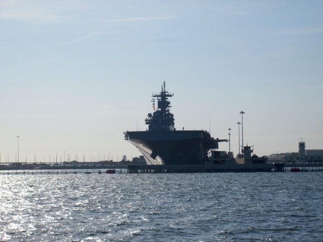
We left Portsmouth and went past Norfolk. We saw many more Navy ships in various stages of repair. We then went past some Navy ships and submarines that looked like they could soon be deployed.

We then headed out onto Chesapeake Bay. At the southern end the bay is very wide and open to the ocean, making it prone to be rough. As usual the weather forecast was wrong and it was much windier and the waves were bigger than forecasted. We were lucky that the wind was out of the south putting the waves right on our stern. If the waves have to be big, we prefer them on the stern. We were surfing up and down the waves, but were still pretty comfortable.

While we were traveling we could see schools of bait fish bubbling on the surface. We also saw many stingrays and I saw one small shark.

We went to Tangier Island and stayed at Parks Marina. The marina owner, Milton Parks, is 83 years old. He rode out on a two wheeled scooter to meet us, and tell us a bit about the island. Visiting this island is like stepping back in time. All of the buildings are very small and old. We didn't have any internet or cell phone service. Everywhere along the waterfront there are crab boats and small crab processing shacks. I'm so glad we stopped here and got to see this small island. There's lot's of history here and it is even more remote than some of the other small towns that we have seen. Plus we had delicious crab cakes for dinner.


More Navy ships being repaired


Tangier Island is very low lying, but we could see the water tower from a distance

Heading into the harbor


Crab shacks line the harbor


Sunrise at Tangier Island 

Fancy homes on a very small island just east of Tangier Island. Theses are much bigger & fancier than anything on Tangier